HYDROGRAPHIC SURVEYS
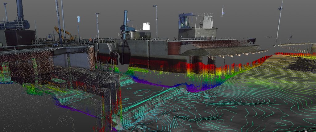
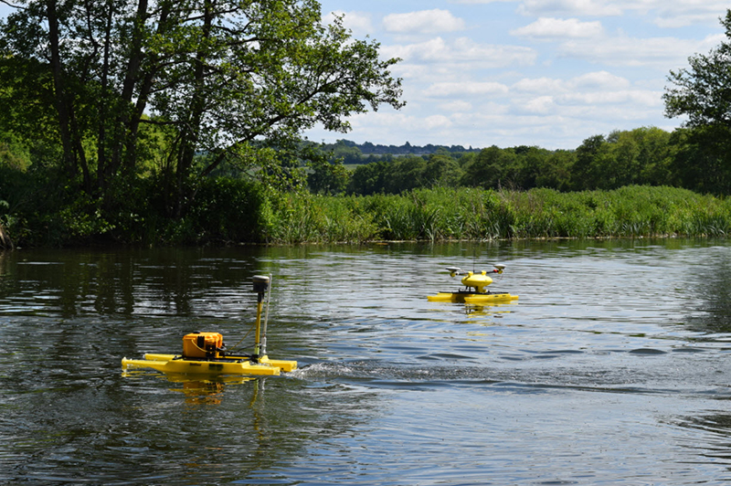
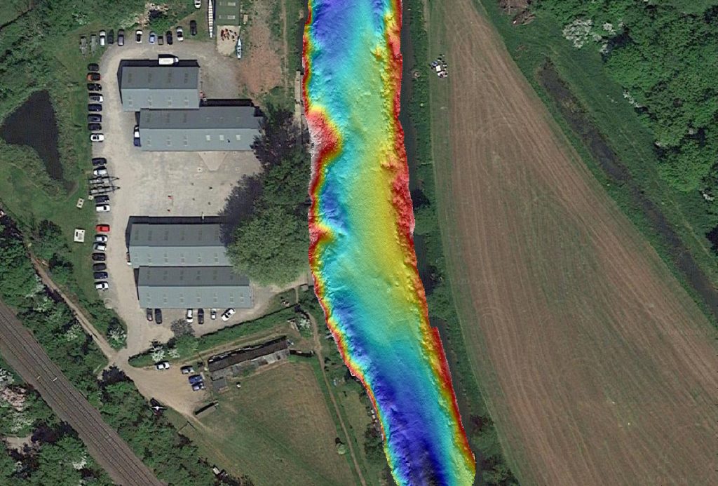
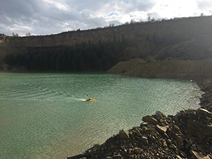
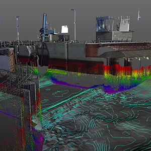
L&SS have advanced its surveying capabilities with the introduction of a Remote Controlled Bathymetric Surveying vessel. This system offers a FAST, SAFE, ACCURATE and Cost effective solution to your river or open watercourse surveys. Linking echo sounding, total station and GPS data gives real time views of the bed as you survey.
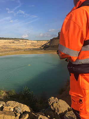
Ideal for continued Quarry excavations, Inland watercourses, Pre – Intermediate – Post dredging works, Ponds, Lagoons.
- Shallow water data collection
- Quick Deployment without the need for a slipway
- Safe and real-time visualisation of the data capture negating the need for re-visits
- Green Survey – No Oils, Smoke, Noise with the use of electrical motors
- Depth Range 0.5m – 75m
- Safe operating conditions
- Fast data acquisition

- Site visit for an analysis on the survey required and determine the best and safest way to carry out the works
- Combined Topographic, Scanning (under bridges, water structures) and Bathymetric survey solutions
- Ideal for those hard to reach areas, under bridges, canopy’s, small channels, lakes and canals.
- Mobile unit can be deployed for difficult to reach areas by other larger vessels.
- Using existing site control or establish new control by GPS or Total station techniques.
- FAST accurate surveys, no need for site re-visits as the operator has full real time images, as the survey is undertaken.
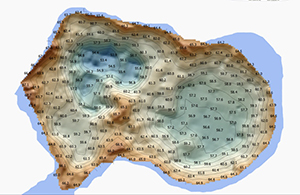
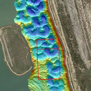
- Deliverables in many formats, Electronic media 3D Auto CAD, 3D model Visualisations, Volume reporting, Hec-Ras and ISIS.
The Latest Technology
We are committed to using the latest technology and surveying techniques to enable us to provide fast, accurate data acquisition in all areas of surveying both land and in the water.
Safe and real-time visualisation of the data capture negating the need for re-visits
HYDROGRAPHIC SURVEYS

Land and Satellite Surveys
Phone: 07885 266 029
Email: info@landandsatellitesurveys.co.uk

© Land and Satellite Surveys, 2020